Reading Time: 7 minutes
Bushwalking Victoria contributed to this article.
Overview
Victoria has many parks and reserves offering a wide range of bushwalking choices. Walking options include walks in arid mallee scrub country, on alpine plateaus and peaks, beside rivers and lakes or along spectacular coastlines.
Climate
Victoria’s climate varies across the state, but overall it tends to be a little cooler and wetter than most other states. The climate is generally mild, but days of extreme summer heat can occur causing park closures due to fire risk. Inland areas in the north and west of the state can be very hot, for extended periods over summer and maximum daily temperatures of 40°C and higher are common. In winter, alpine areas are subject to blizzards and higher ground is under snow.
Bushwalking areas and notable walks
North east Victoria
The Victorian Alps are forested mountains with snow plains at higher elevations. They are part of the Great Dividing Range that continues north up to Queensland. The Alpine National Park extends to the NSW border and includes dramatic peaks and alpine areas that are snow covered during winter and early spring.
Bogong High Plains. The alpine resort of Falls Creek is reached through the small town of Mt Beauty. From there the open alpine healthland of the Bogong High Plains can be explored. There are good tracks for day, overnight and extended trips and off-track walking is also possible. The highest peaks Mt Cope, Mt Nelse, Spion Kopje and Mt Bogong are all worth climbing and the heritage huts add historical interest. In winter, the area is covered by snow providing excellent ski touring for experienced tourers.
Mount Hotham. Access to Mt Hotham, Mt Feathertop and Mt Loch is through the township of Bright or via Omeo. Good tracks lead to each peak for day and overnight trips. Like Falls Creek, Mt Hotham is a large skiing resort with a good range of marked ski-touring trails and some off-trail touring in winter.
Falls to Hotham Alpine Crossing is a 37km track that can be walked in either direction between the alpine resorts of Falls Creek to Mt Hotham. It takes three days to walk and camping platforms, if planning to use them, must be booked in advance.
The Mount Buffalo plateau features spectacular granite rock formations, cliffs, waterfalls and alpine flora. There are short walks to spectacular lookouts and some longer day walks on tracks through snow gums. Overnight bushwalks are limited to two camping areas. There is a good base campground beside Lake Catani. The plateau is snow-covered in winter with some cross-country ski trails.
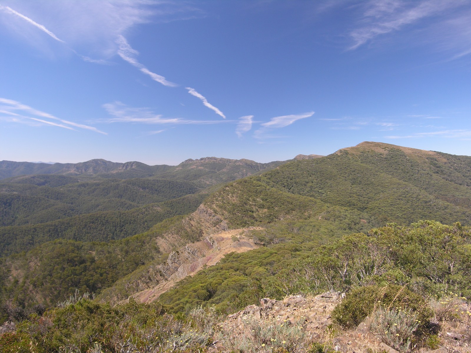
Mansfield region. Mansfield provides good access from the west into the Alpine National Park. A wide range of short and long trips of all standards are possible. Eagles Peaks, The Bluff, Mt Magdala, Mt Howitt, Cross Cut Saw, Speculation, Razor, Viking and Mt Stirling are just some of the favoured places here. The area is suitable for walking in the warmer months. In winter, Mt Stirling has many cross-country ski trails; some of the other higher peaks are suitable for overnight or extended trips by experienced ski tourers.
Australian Alps Walking Track starts or finishes in Walhalla and meanders northward to Tharwa near Canberra. The 660km track makes its way through tall forests, along ridges and across alpine grasslands. It takes about six to seven weeks to complete the whole journey. An alternative for many walkers is to complete the track in one- or two-week sections each year.
The Cobberas mountain range is located in the Cobberas Wilderness area of the Alpine National Park. The circuit walk to the rocky summit of Mt Cobberas No. 1 should only be attempted by experienced walkers.
East Gippsland
Croajingolong National Park is a large coastal national park in far east Gippsland. Weekend circuits to multi-week trips are possible, but there are also a number of excellent shorter walks that take in interesting sections of coastline, isolated beaches, sand dunes, the shore line of Mallacoota Inlet and the historic Point Hicks Lightstation.
The Wilderness Coast Walk stretches 100km, along beaches, cliff tops, across heathland and over low, rocky headlands. It starts from Bemm River in Croajingolong National Park and experienced walkers can continue through to Wonboyn in Nadgee Nature Reserve, New South Wales. River estuaries may require swimming, Advance bookings for camping along the walk are required.
Snowy River National Park has a few shorter walks, but is best suited for experienced walkers undertaking multi-day walks to visit gorges, waterfalls and tall forests.
East Gippsland has other extensive forest areas, where bushwalking is also possible, including Mount Tingaringy, Errinundra National and Coopracambra National Parks.
West Gippsland
Wilson Promontory National Park is the southernmost tip of the Australian mainland and is a very popular destination. It has excellent coastal and mountain scenery with a network of well-maintained walking tracks for one-day and overnight trips. It is suitable for year-round walking. There is a permit system for all overnight walks. The southern end is the most popular section of the park. The northern end is less visited and best seen on a three-day walk. Tidal River is the Park headquarters with a large camping area and some shops. Bookings are required and a ballot system operates for the summer months and Easter school holidays.
Baw Baw National Park is an elevated, granite plateau with snowgum-clad ridges and some open heathland. It is a good day and overnight walking area with ski touring trails when under snow. There is a small ski resort near Mt Baw Baw.
Licola and Dargo regions. The small towns of Licola and Dargo have good access roads into the southern section of the Alpine National Park. There are many good one-day walks and a wide variety of overnight trips. Base camps are possible and popular. Lake Tarli Karng, The Crinoline, Caledonia River, Snowy Bluff, Bryces Gorge, Moroka River, Wonnangatta Valley and Mt Howitt are some of the popular destinations. The area is suitable for the warmer months from spring to late autumn. In winter the higher peaks and plains are often snow covered and offer interesting ski touring when conditions permit. Access is difficult in winter as the approach roads are not cleared. Some roads are seasonally closed.
McMillans Walking Track. This 210km track traverses the Victorian Alps from Cobungra near Omeo through to Woods Point linking the Gippsland goldfields. It passes some historic relics and mountain huts. There are numerous river crossings along the way.
Central Victoria
The goldfields around Bendigo and Castlemaine include some drier forests and many historic sites from the nineteenth century gold rushes that brought great wealth to the State. The Goldfields Track is a point-to-point, 210km track that takes bushwalkers through some of central Victoria’s most historic towns and beautiful forests.
The area around Marysville has day walks through lush forest to Steavensons, Keppel and Phantom Falls. The nearby Lake Mountain plateau and Mt Torbreck also have day walks. In winter, Lake Mountain has popular but limited cross-country ski trails. Cathedral Range State Park is a spectacular ridge of sharply upturned sedimentary rock with a variety of walking tracks ranging in difficulty from easy strolls to those involving challenging rock scrambles making some tracks unsuitable for beginners. They offer the opportunity to explore the park’s main features and climb the peaks to enjoy views of the forests and farmland in the valley below either as day walks or an overnight trip.
Kinglake National Park, Mt Disappointment State Forest and Strathbogie Ranges are a series of forested ranges north of Melbourne. There are many good one-day walks and some overnight walks suitable for less-experienced groups as the walking is relatively easy.
The Central Highlands to the east of Melbourne include large areas of forest with some pockets of cool-temperate rainforest including the Dandenong Ranges and the Yarra Ranges National Park.
South west Victoria
South West Victoria has some dramatic coastal terrain including the Twelve Apostles and the Otways mountain ranges that provide excellent bushwalking.
Great South West Walk is a 15-day, 220 km circuit in the far south west corner of the state. It features the Glenelg River and varied southern coastline with long sandy beaches and some spectacular cliffs. Shorter circuits of two and three days based on Mt Richmond or the coastline are possible.
Great Otway National Park. Covered in tall forest, the Otway ranges rise above the southern coastline and contain many waterfalls. There is a variety of marked tracks to many waterfalls providing good one-day walks. The most popular regions are near the towns of Aireys Inlet and Lorne, around the Cumberland River, near Beech Forest
The Great Ocean Walk traverses the Otway coast for 110 km. It is an 8-day walk featuring tall forests, coastal heathlands, cliff-backed beaches and tidal platforms.
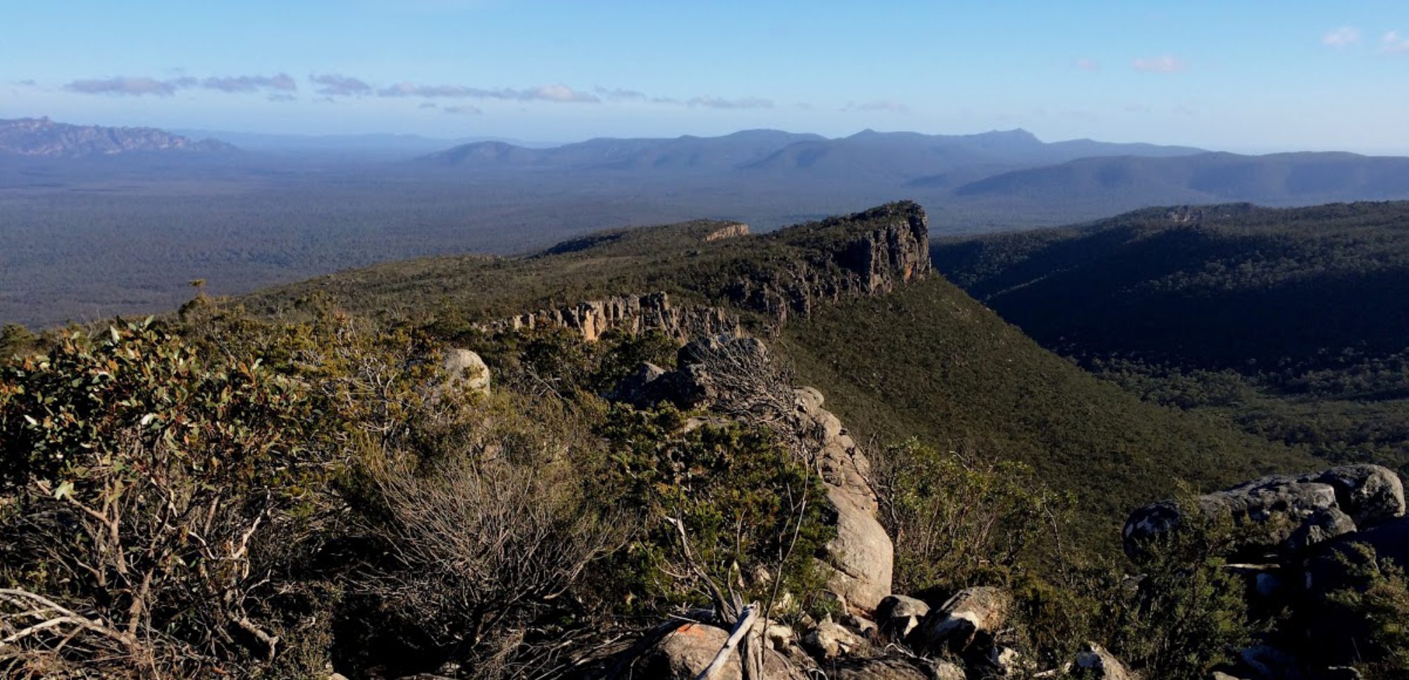
Grampians National Park
The Grampians (Gariwerd) National Park is a series of dramatic sandstone ranges rising above Victoria’s western plains. The park is renowned for its wildflower displays in spring. There are many day walk options on well-maintained tracks in the Wonderland, Mt Difficult and Mt Stapylton areas. Overnight camping is currently permitted at The Fortress, along the Grampians Peaks Trail and other designated areas.
The Grampians Peak Trail is under construction as a multi-day walk.
Mt Buangor State Park, Mt Cole and Langhi Ghiran State Forests are east of Ararat and have several walking tracks for day and overnight trips. The area is best in autumn and spring and suitable for less-experienced groups as the ranges have good access, the walking is relatively easy and the ranges are of low elevation.
The Lerderderg State Forest and Wombat State Forest close to Melbourne are popular bushwalking locations with a variety of day walks possible. The overnight walk down the Lerderderg Gorge is for more experienced walkers, when river levels are low.
North west Victoria
The north west region is generally dry and can be very hot in summer. It includes the Murray-Sunset, Wyperfeld, Little Desert, Hattah – Kulkyne, Gunbower and Barmah National Parks. There are a variety of one-day and overnight walks to visit dry lakes, sand ridges and mallee vegetation, or that meander along the mighty Murray River. Late autumn to early spring is the best time to walk.
Emergencies
See also
Ambulance cover: essential for all bushwalkers
Interstate visitors should check that their home state or territory ambulance cover has reciprocal arrangements with Ambulance Victoria.
International visitors should confirm they have travel insurance that covers bushwalking.
Current weather, emergency and safety information
Well prior to a trip, each group member should, on their mobile phone*:
Install the Vic Emergency app, and become familiar with the warnings, setting a watch zone and notifications.
- VicEmergency – Google Play
- VicEmergency – Apple App Store
Install the Bureau of Meteorology weather app:
- BOM Weather – Google Play
- BOM Weather – Apple App Store
Bookmark the websites below, which provide current local advice and emergency warnings.
- Incidents and warnings (map) – Vic Emergency (or the app above)
- Victoria weather and warnings – Bureau of Meteorology (or the app above)
- ABC Emergency – current local emergency information from the ABC
- Nurse on Call – Phone 1300 60 60 24, Vic Health. (Ring 000 for emergency)
- Fire affected parks – Parks Victoria
- Road conditions and closures – VicTraffic
- Planned fuel reduction burns – Forest Fire Management Victoria
- Current air quality – Environment Protection Authority Victoria
*Useful only when there is phone network coverage.
General information
- National Parks Victoria – Parks Victoria
- All abilities access – Parks Victoria
- Topographic maps – Vicmap
- Department of Environment, Land, Water and Planning (DELWP)
Bushwalking peak body
Bushwalking Victoria – provides general information on bushwalking, including this manual, and on the State’s bushwalking clubs.