
Reading Time: 5 minutes
Google Maps and Apple Maps are familiar, ubiquitous navigation Apps.
While invaluable for day to day use, including walks along shared trails and coastal paths, the maps in these Apps lack the accuracy and terrain detail of contours, tracks, creeks and watercourses needed for bushwalking.
There are Map Apps much more suitable for bushwalking. Some are straightforward to use, while others have sophisticated features that the technically minded enthusiast will enjoy.
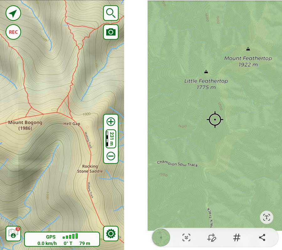
An essential feature of all Map Apps is that the current location is shown on the map on the device screen. This is called geo-referencing. The coordinate system of the map links to the location coordinates determined by the device GPS.
This is only a brief overview of Map Apps. Detailed instructions on the use of any particular Map App, and more generally, can be readily found on-line, and within the Apps. The technical aspects of GPS and geo-referenced maps are intentionally avoided.
Choosing a Map App
- Talk to other bushwalkers, read reviews and try the free or trial versions.
- What topographic maps are provided in the App?
- Are they suitable for bushwalking? How well does the map detail in the App reflect familiar areas and the routes of recent bushwalks?
- Can maps of specific areas, or a map series be purchased? Good maps have to be paid for, generally.
- Is there a free version, with the option to upgrade to a fully-featured version at additional cost or subscription?
- Can other geo-referenced maps be imported?
- Can a switch to Google Maps be made within the App? (Satellite view is useful.)
- Can the App be used on multiple devices (phone, tablet, PC) with one account?
- Is the App reasonably easy to use? This is subjective, of course; dependent on the user’s digital skills and interest.
Map App settings and functions
Settings to be configured will include:
- units
- map orientation: direction of travel up (oriented), or north up?
- map datum (UTM is commonly used*)
- compass bearings: true or magnetic?
- line/route share/export format
- screen timeout: how long on, or turn off, when viewing map screen. Useful when navigating in difficult conditions. However, it will increase battery drain.
Any GPS technical settings are best left on the defaults.
Functions to learn, through practice, include how to:
- select and download the best maps
- mark a location (waypoint/pin), label/name it, and share/export
- draw a route, save, and share/export
- import a track log/route
- navigate to a location (‘go to’)
- switch between north up, and direction of travel up (oriented)
- view and calibrate the compass
- turn screen timeout on/off.
*UTM is a 14-figure grid reference system. With a bit of practice, this long form grid reference can be read as a ‘traditional’ 6-figure grid reference. This is useful if a paper topographic map is also being used.
Planning a route for a trip
When the most suitable maps have been selected and downloaded in the App, the route planning and consideration of campsites is best done on the larger screen of tablet, laptop or PC. The small screen of a mobile phone is a limitation for route planning, especially for off-track routes.
Key points, including vehicle rendezvous and parking, campsites, track junctions, water points, summits and other points of interest, can be marked (waypoints/pins), and labelled. The planned route can be drawn, saved, and shared/exported. If saved as a GPX file, it can be uploaded to a handheld GPS.
These waypoints/pins of key points on the route are invaluable aids for navigation on the trip.
Most Map Apps allow file saving in Google Earth format (KML/KMZ), so the trip information can be shared with everyone in the group, including those not familiar with other Apps.
Google Maps satellite view
Viewing the key points of a trip in Google Maps satellite view is interesting, and, depending on the trip, very useful for planning and navigation. For off-track trips, essential viewing.
Vegetation type and boundaries, rocky areas, indication of cliff lines and burnt areas can be observed. Some tracks will be obvious, others indicated by intermittent scars in the vegetation. The satellite image needs some practice to interpret. Familiarity with the area and type of terrain helps.
Google Maps satellite view of a selected area can be downloaded to a mobile phone. As with the maps, it should be done prior to a trip.
Some Map Apps provide a switch to Google Maps from within the App. Satellite view can be very useful.
Backup
Do not rely on a single means of navigation on a trip. The backup can be:
- a second GPS device (another group member’s device, unless walking solo), and power banks.
- paper maps and a compass.
Caution: Map Apps do not decide the route
- Google and Apple Maps suggest route options along streets and roads to a destination, with turn by turn navigation along the way, made possible by the way the detailed, accurate, and up to date base map is digitised.
- Walking tracks and vehicle tracks in the bush are not digitised in the same way, so reliable Google style turn by turn navigation is not possible. Further, as every walker knows, the mapping of bush tracks is nowhere near as accurate or up to date as the road and street network.
You need to decide the route to be taken. Map Apps do not provide route options.
Tracks from Apps
Walking guides in the form of an App for a specific iconic or classic walk are available. These Apps typically provide information that can be downloaded for off-line use, including a GPS route/track log (GPX file) and notes on campsites, water points, track conditions, etc. Some include information and comments from walkers who have done the walk.
More generally, there are Map Apps that provide track/trail notes and logs for many areas that can be downloaded to a mobile phone and used for navigation. A significant issue is that the information is crowd sourced. The “map” is not equivalent to the quality of a topographic survey map, a professionally prepared outdoors map, or the maps provided by land managers for National Parks and other public land. There is no way of knowing, except perhaps by finding out when it’s too late, how well the person whose track you are following could navigate and route find. Did they take a shortcut? Or miss a track junction?
Accuracy questions aside, some may find these Apps useful. Others may feel that a GPS breadcrumb trail can encourage a form of navigation similar to using a vehicle GPS to get to a destination; following a route without reference to landmarks, interesting locations or the fun of route finding.
If a departure from the track log route provided by the App is desired or forced, for example due to weather, closed tracks or an accident, the App will not provide an alternative route.
As noted in Map and Compass Basics, a paper map and compass and the ability to use them remains important, at least as a backup – especially on a long-distance “classic” or iconic trip.
Some Map Apps (2023):
Avenza
- Avenza Maps: Offline Mapping – Google Play
- Avenza Maps – Apple App Store
OS Maps
- OS Maps: Hiking trails & walking routes – Google Play
- OS Maps: Walking & bike trails – Apple App Store
Terra
- Terra Map – Outdoor GPS – Google Play
- Terra Map: GPS Hiking maps – Apple App Store
Ozi Explorer
- OziExplorer Web Site – GPS Mapping Software for Tracking and Navigation (supports Garmin and Magellan GPS)