
Reading Time: 7 minutes
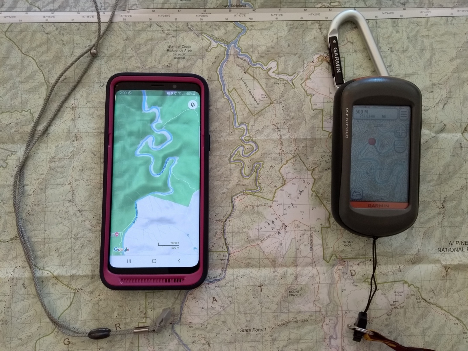
Using a mobile phone or handheld GPS for bush navigation.
Where to from here?
A GPS gives the current location on a map on a screen on a device.
“Where to from here?” is the question.
A handheld GPS, or a mobile phone Map App will:
- not determine an alternative bushwalking route
- not offer route choices
- not highlight the best track to follow, or which spur to descend.
- not download a fresh map if there is no phone signal.
Either device will give a bearing and distance from the current location to a destination. This straight line is very unlikely to be the best route.
Importantly, this is very different to the familiar Google, Apple and Waze maps, routinely used to navigate streets and roads to a destination with turn–by-turn navigation along the way while the map progressively downloads to your phone.
While invaluable for day to day use, including walks along shared trails and coastal paths, Google and Apple Maps lack the accuracy, features and terrain detail including tracks, contours and creeks needed for bushwalking.
Reading a topographic map
Being able to read a topographic map is still an important skill for bushwalkers, even with the advantages a GPS provides.
A paper topo map is ideal for viewing a larger area in the detail needed to consider and decide on the most suitable route. Further, a paper map may be the only option if, for example, a device battery is flat.
In any event, the navigation techniques used with paper maps are also very useful when using a digital map. See Practical navigation:
It is neither feasible or enjoyable to walk while constantly peering at a small screen to check if still on that route or breadcrumb trail.
This is avoided by checking the next stage ahead on the map on the Map App or handheld GPS and any track notes. Terrain and other features are noted, and challenges can be anticipated. (... track follows the undulating ridge roughly west … track climbs the spur to a summit … about 1.5km to the track junction in a saddle … route is down the spur, use compass, XYZ deg Mag, .. etc). No different to using a paper map.
Preparing for a trip
- Download the maps required.
- Decide or confirm the route. The small screen of a handheld GPS is a limitation. For extended or challenging trips it is much easier to see the ‘big picture’ and route options on a paper map, or the larger screen of a tablet or PC.
- Review any track notes and paper maps. Compare the detail from these and the GPS map. Are key locations such as vehicle rendezvous, campsites, track junctions clear? Can the route be clearly identified? There always are some differences between maps, with track detail being most likely. Are those differences significant? Which source has the best information?
- If the Map App or handheld GPS is new, learn the functions and practice using them.
- Pack at least 1 power bank battery and correct cable, to recharge the phone (solar panels are an alternative on extended trips).
- If using a mobile phone, have a heavy duty case with a lanyard attachment and a waterproof pouch for when not in use.
Mobile phone Map App, or a handheld GPS?
A mobile phone Map App and a handheld GPS are both suitable for bush navigation. They have the same functions, and are used in the same way.
Why use a mobile phone?
Advantages
- Familiarity with the operation and settings.
- will be carried anyway for emergency communications, forecasts, etc..
- No need to purchase and carry another device.
- additional maps can be readily downloaded prior to the trip in the Map App, for offline use.
- Larger screen than most handheld GPS devices.
- Convenient to learn to use a selected Map App, as the phone is always at hand.
Limitations
- Battery life is limited, and easy to inadvertently drain. See Mobile phones.
- The screen can be difficult to read in bright conditions and very difficult to use if wet, cold, shivering, sweaty or otherwise impaired.
- Mobile phones are less robust so more easily damaged.
- Not waterproof. Some models are water resistant at best.
A phone most suitable for bush navigation will:
- be water resistant
- have a relatively long battery life
- be of relatively robust construction
- have a “glove” setting; allowing gloved fingers to use the touch screen.
- have a large memory for storing downloaded maps
- have an armoured case and lanyard.
Which Map App?
See Map Apps.
Why use a handheld GPS?
Advantages
- Made for rugged conditions:
- robust construction
- waterproof, dustproof
- lanyard attachment and snaplink for security.
- Quality topographic map of Australia (or other country) purchased with the device.
- Toggle and buttons are better than a touch screen in adverse conditions.
- Long battery life.
Disadvantages
- Another expensive device to purchase and carry.
- Screen size is smaller than a mobile phone.
- Map options are fewer and less convenient than the choices in a good Map App.
Which GPS model?
A handheld GPS with topographic maps suitable for bushwalking is expensive. The two main manufacturers are Garmin and Magellan. Both have a range of models. Features vary considerably between models.
Significant points of difference between models include:
- Screen: Some models use a touch screen while others use toggle switches and buttons to operate the map cursor and menu functions. Touch screens are familiar and easy to use, but can be difficult to use in adverse conditions. Screen size is a consideration. Big is better, but uses more battery and is heavier.
- Maps: A quality topographic map of Australia and New Zealand is typically bundled in the GPS purchase. Confirm the detail and quality of the map supplied. Maps of other countries can be purchased if needed. It may be possible to install third party maps.
- Batteries: What type; rechargeable or disposable? Can either type be used? Battery life of either type?
- Durability and water resistance: Handheld GPS units are well designed for rugged outdoor use. Check specifications for shock, dust and waterproofness.
- Emergency communications device: there are models with the significant additional features of satellite tracker, send/receive SMS and an SOS button. These models come at a price, and a service subscription is required.
GPS device and Map App settings
Typical settings are:
- units
- map orientation: direction of travel up (oriented), or north up?
- map datum (UTM is commonly used*)
- compass bearings: true or magnetic. Remember which is set!
- screen timeout: how long on, or turn off, when viewing map screen. Useful when navigating in difficult conditions. Screen on increases battery drain.
- line/route share/export format
- Any GPS technical settings are best left on the defaults.
Typical functions are:
- source of maps:
- Map App: select and download suitable maps.
- Handheld GPS: entire country map (Aus) pre-installed.
- mark a location (waypoint/pin), label/name it, and share/export
- draw a route, save, and share/export
- import a track log/route
- navigate to a location (‘go to’)
- switch between north up, and direction of travel up (oriented)
- view and calibrate the compass
- turn screen timeout on/off.
*UTM Grid References 14 figure, 6 figure.
UTM is the acronym for the standard, commonly used, map datum or grid reference system. With a bit of practice, a 6-figure grid reference can be read from the full 14 figure UTM grid reference for a location. This 6-figure grid reference is used to find the same location on a paper topographic map. The map’s grid lines will be the UTM grid.
Learning to use handheld GPS or Map App
It takes a while to set up and learn to use a handheld GPS/phone Map App. Reading the instructions is a start, but a better option is to walk with someone who already has a similar model. First, learn and check the settings. Then do lots of practice using the device on walks.
Some basics
Map screen: Most useful with the current location shown in the centre of the screen; the default. Screen can toggled between North Up, or direction of travel (Oriented) up depending on user preference and the circumstances. When planning a route, for example, North Up is generally best, especially if a paper map is also being used.
Track logs: The GPS will record and save a track log (“breadcrumb trail”) of the path taken. The file can be renamed; e.g. Day 6 AAWT. It is saved on the device, and can be shared. Aside from recording for posterity, the tracklog is invaluable if a route needs to be back tracked or re-traced. Track logs of others can be loaded.
Waypoints: The location of points of interest can be marked with a name e.g. Day 6 Camp. Waypoints can be plotted and named on the Map App or handheld GPS when planning the trip to aid navigation, and recorded during the trip for interest and later reference. Waypoints add detail to the track log.
Compass: The device can be set to ‘go to’ a particular location; a waypoint, or a summit for example. The compass screen will give the bearing to that location and a distance. This is particularly useful when the going gets difficult. When an obstacle is encountered and bypassed, the compass will adjust the bearing and distance accordingly.
The compass will need to be re-calibrated from time to time, to ensure it is accurate. This is a simple process.
Route: A predefined path saved on the device. It is created by joining a sequence of locations/waypoints, so is just a series of straight lines between waypoints. Not so useful for bushwalking.
Backup
Do not rely on a single means of navigation on a trip. The backup can be:
- a second GPS device or mobile phone, (another group member’s device, unless walking solo), and power banks.
- paper maps and a compass.
No technical detail or instructions
This is only a brief overview of GPS navigation. There are many Map Apps and handheld GPS devices available. Detailed instructions are beyond the scope of this Manual. The technical aspects of GPS are intentionally avoided.
References and external links
- Beginners guide to choosing a GPS device
- Garmin handheld GPS
- Garmin inReach handheld GPS and satellite tracker with SOS button
- Magellan handheld GPS
- OziExplorer mapping software for laptop or PC
GPS watch
A watch with a GPS is NOT an alternative to a mobile phone with Map App or a handheld GPS for bush navigation.
The main reasons are a tiny screen size, limited battery life and fiddly buttons.
For the enthusiast, a GPS watch designed for outdoor activities can be a convenient way to check the distance covered, current grid reference, elevation and general direction, and to record a waypoint or check a breadcrumb trail. However, only some top line models have all these features.
For bush navigation a good mobile phone with Map App, or a handheld GPS is far more useful and practical.