Reading Time: 5 minutes
Overview
Tasmania has some of the longest and most challenging walks in the country. Many are located within the Tasmanian Wilderness World Heritage Area which represents about 20% of the state’s area. However, there are also other areas that offer varied and scenic walking possibilities, including many excellent short walks around the state.
Glaciers once covered substantial areas of the state. They carved numerous lakes and rugged cliffs which, together with extensive button grass plains and large tracts of forest, create Tasmania’s unique landscape.
A park pass is required for entry to all national parks. Advance bookings are required to walk the Overland and Three Capes Tracks.

Climate
Tasmania has a temperate climate, with four distinct seasons. Weather conditions vary from coastal areas to the central highlands. Weather conditions can change quickly with heavy rain, strong winds and even snowfall possible during summer months.
Summer is the best and safest walking period on the higher peaks and plateaus as they are often snow covered during winter and early spring. Coastal regions have a generally milder climate and are suitable for bushwalking during all seasons.
Bushwalking areas and notable walks
Cradle Mountain – Lake St Clair National Park
Cradle Mountain – Lake St Clair National Park is a glaciated landscape with many lakes, cliffs, peaks and plains providing grand scenery. There are many good one-day walks and overnight walks on lesser-used tracks within the park starting at the visitor centres at Cradle Mountain or Cynthia Bay.
The famous Overland Track traverses the park for 65 km on a well-maintained track. It can be completed in five days. The track passes through a variety of landscapes including glacially-carved valleys, buttongrass moorlands, alpine meadows, eucalypt and rain forests. Most walkers finish at Narcissus Hut at the southern end and take the ferry down the lake to the visitor centre at Cynthia Bay while others add an extra day to walk the 17 km alongside the lake to the end. Only experienced, well-equipped walkers should undertake the walk during winter and early spring.
Central Plateau Tasmania
The area to the east of Cradle Mountain is an elevated plateau covered with low vegetation. The Walls of Jerusalem is the most popular feature and has good tracks for day and overnight walks. The remainder of the plateau is an essentially trackless region where it is possible to walk across a wide area and is a good location for overnight or longer walks.
Franklin-Gordon Wild Rivers National Park
Another huge wilderness park is the Franklin-Gordon Wild Rivers National Park which includes the well-known Franklin and Gordon Rivers. It is located between the South West and Cradle Mountain parks. There is only one marked track, of 3-5 days return, to Frenchmans Cap. The Denison Range and the King William Range are difficult, off-track trips, suitable only for fit, experienced, well-equipped walkers.
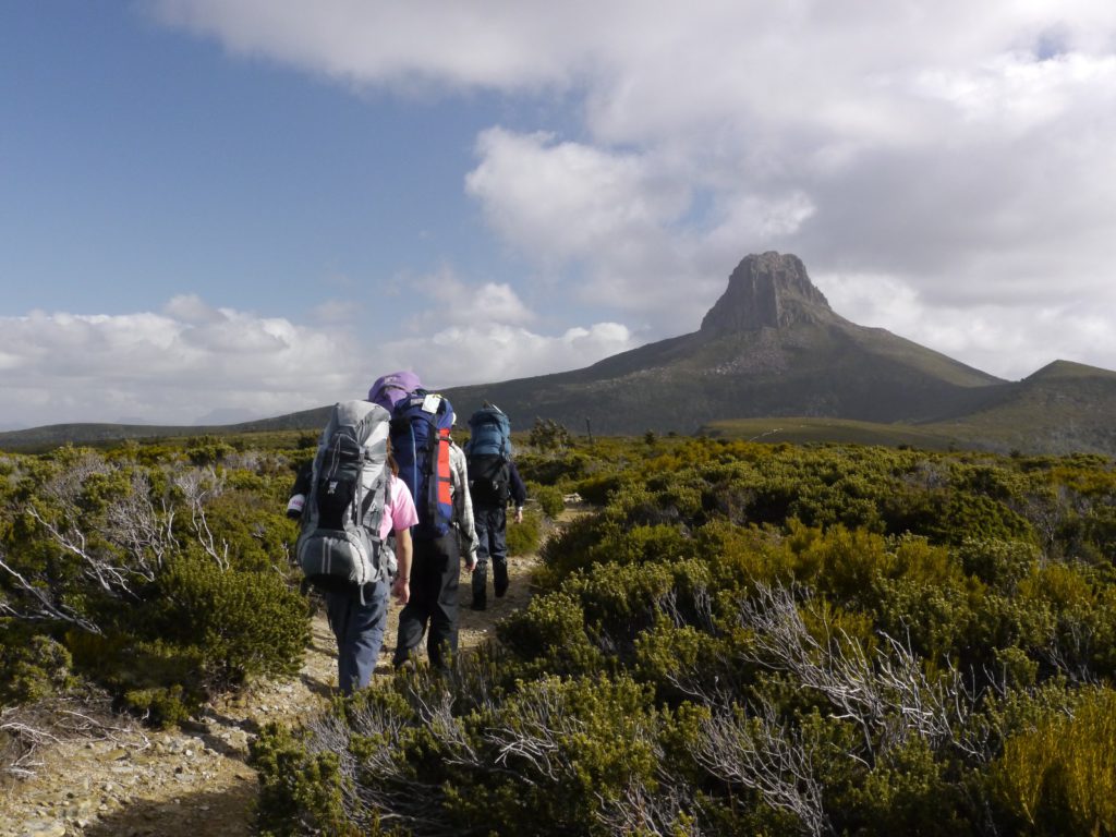
Frenchmans Cap. This half-dome peak, the most prominent in the Wild Rivers National Park, requires a minimum of three days for a return walk to the summit. The track is about 23 km each way and is rough and muddy in places. There are a few steep sections including the scramble to the summit which is best left for good weather as views from the top are a highlight. The track includes buttongrass plains, passes through rainforest and glacial valleys to Lake Tahune, perched under the huge quartzite cliff face of the Cap.
Mt Field National Park
Mt Field National Park is an elevated plateau in central Tasmania that has good tracks providing many one-day walks and some easy overnight walks. The park includes the scenic Russell Falls and also has other walks leading to beautiful lakes and boulder strewn mountain tops.
South West National Park
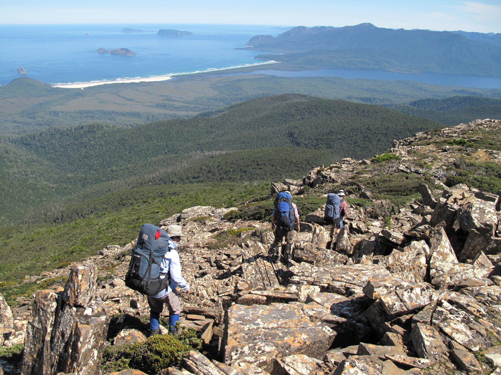
South West National Park is a large wilderness area with rugged, glaciated ridges, buttongrass plains and a spectacular coastline. The South Coast, Port Davey and Arthur Plains Tracks are the main, clearly-defined walking tracks in the area. Walking any part of these tracks is relatively easy for experienced walkers in good weather, but can be very challenging in severe weather which can occur here in any season. There are other popular, but harder routes in the area such as Federation Peak, Mt Anne, the Western Arthurs, South West Cape and Precipitous Bluff.
South Coast Track. The track traverses the southern coastline for 85 km between Melaleuca and Cockle Creek. It is one of the world’s great wilderness walks. Walkers must either fly, sail or walk in or out of Melaleuca which has the only walkers’ hut on the track. There are no other services apart from some toilets at the major campsites. Most walkers take 5 to 9 days to complete the walk, depending upon time spent enjoying the beaches.
Tasman Peninsula
There are spectacular coastal cliffs on the Tasman Peninsula. A track system exists to most features and some day walks are possible.
The Three Capes Track starts at the World Heritage-listed Port Arthur Historic Site. The 48 km, 4-day walk begins with a boat ride across the bay, bookings are essential. Camping is allowed at two sites and most of the features can be visited without booking a hut-based trip. The track passes through eucalypt forests, heathlands and moorlands. Views of impressive sea cliffs abound and from The Blade at Cape Pillar there are good views of the dramatic cliffs of Tasman Island. The peninsula is suitable for year-round walking.
East Coast Tasmania
Maria Island, Freycinet Peninsula and Douglas-Apsley are the three major national parks along the east coast. They have marked tracks for good one to three-day walks. The area is suitable for year-round walking as the climate is much drier than the rest of the state.
Ben Lomond National Park
Ben Lomond National Park is a high, rocky plateau in the north east. Day walks are possible in summer along rough tracks marked by snow poles. In winter, the small ski resort provides opportunities for ski touring, downhill skiing, snowboarding and tobogganing.
North Coast Tasmania
Mt William, Narawntapu National Park and Rocky Cape are three smaller, coastal national parks with some lovely day walks. These parks offer year-round walking.
Emergencies
See also
Ambulance cover: essential for all bushwalkers
Interstate visitors should check that their home state or territory ambulance cover has reciprocal arrangements with Ambulance Tasmania.
International visitors should confirm they have travel insurance that covers bushwalking.
Current emergency and safety information
Well prior to a trip, each group member should, on their mobile phone*:
Install the Bureau of Meteorology weather app:
- BOM Weather – Google Play
- BOM Weather – Apple App Store
Bookmark these websites, which provide current local advice and emergency warnings:
- Alerts map – Tasmania Fire Service
- Tasmania weather forecasts and warnings – Bureau of Meteorology
- ABC Emergency – current local emergency information from the ABC
- Alerts: closed areas and hazards – Tasmania Parks and Wildlife Service
- Roadworks map – Transport Services – Service Tasmania
- Fuel reduction burns – Tasmania Fire Service
- Air quality – Environment Protection Agency, Tasmania
- Community alerts – Tasmania Police
*Useful only when there is phone network coverage.
General information
- Tasmania Parks and Wildlife Service
- Access friendly – Tasmania Parks and Wildlife Service
- TASMAP eshop – Tasmania topographic maps
Bushwalking peak body
- Bushwalking Tasmania – provides general information on bushwalking, and on the State’s bushwalking clubs.

